
Wednesday, September 13, 2023
Pretty much final plans
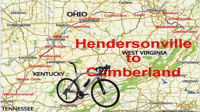
Attached are the latest cues and plans for our Ride To Cumberland. The only changes of note are some different rooming arrangements in Columbus, Grantsville, and Cumberland where Ross will be staying in room with Bob and Bruce.
One pleasant change is DTI (David Irvine) will be joining us in Grantsville and cycling with us to Cumberland. Tom Benim has graciously volunteered to shuttle Dave and I back to Grantsville to fetch our vehicles so the entire crew can cycle together.
Tom B and Jennifer will be cycling that same day, Sat, Sept 30, north via the GAP and meet us in Meyersdale, or somewhere along the way.
Note, Bob's USA cell number is 629-200-9902
OK, paperwork done. Time to work on my motor.
Bruce,
Wednesday, September 6, 2023
UPDATE 09/05/23
As of now
Leaving from Hendersonville and cycling to Cumberland
Ross Sherman
Bob Schofield
Tom Evans
Bruce Day
Starting in Columbus, OH and cycling to Cumberland, MD
Philip Vickery
Jimmy Rivera
Joining at Grantsville/Meyersdale on GAP,
David Irvine
Jennifer Galvin
Tom Benim
Returning to Hendersonville via Ross's van
Ross Sherman
Tom EvansPhil Vickery
Jimmy Rivera
Bruce Day
Roommates easier with Tom/Ross, and Bruce/Bob. From Columbus it will be Tom/Ross, Bob/Bruce, Phil/Jimmy.
Grantsville is only 30 miles from Cumberland via I-68 so I'm hoping we can work out a shuttle so we can all cycle the last day together.
I'd suggest not importing the Ride with GPS routes into your GPS units till a couple of days before the ride so as to capture any last minute changes.
The Itinerary, Lodging, GPS, and Fuel Share are on Sked Page. The total fuel cost will be the same as on the sheet. David Shumaker has contributed $200 to fuel cost so I the end result will be the same, $150 for Tom, Bob, and Bruce, $75 for Jimmy and Phil. The initial estimate was very crude with the goal of assuring Ross has no fuel expense.
Oy Vey!
Bruce
Monday, August 7, 2023
FINAL PLANS? - UPDATE
From: bruce Subject: Final Plans
Intrepid Fogbee Tourers,
It's just over a month before we begin the 2023 Fogbee tour to Cumberland, MD. Time to make final arrangements. Here's a link to the Ride With GPS routes collection. https://ridewithgps.com/collections/1773147?privacy_code=osmlxhLaSSXUMmDr
Days 7 and 11 have some recent changes.
- Day 7 has a short detour off the Little Miami Scenic Rail trail due to construction.
- Day 11 has an alternate option to cycle all the way to Munhall via recently discovered bicycle friendly roads and paths. It adds 14 flat miles for an overall flatish 65 miles.
As of now my best guess at participants is listed below. Any omissions or additions need to tell me ASAP. I am working on room and sag duty plans.
Leaving from Hendersonville and cycling to Cumberland
Ross ShermanBobby JonesBob SchofieldTom EvansDavid ShumakerBruce Day
Leaving from Hendersonville and Cycling to Columbus, OH
Andrew Getter
Starting in Columbus, OH and cycling to Cumberland, MD
Philip Vickery
Joining somewhere on GAP as fate allows,
David IrvineJennifer GalvinTom Benim
Bob will continue his tour via shuttle from Cumberland, MD, eventually cycling to Charleston, SC.
Returning to Hendersonville via Ross's van
Ross ShermanBobby JonesTom EvansDavid ShumakerPhil VickeryBruce Day
As of now we have 4 double bedded rooms reserved at all overnight motels which means we have one extra bed. It would be nice to get one more rider to share that room. All motels were chosen for the possibility of adding more rooms if needed but the sooner we know of a need, the better the chance of getting extra.
Please examine the attached file and think about the plans outlined above. I hate to be wrong but much prefer to be corrected by you while I'm in Hendersonville rather than by a cruel world while on the ride.
Sunday, July 23, 2023
Little Miami Trail Block
Bob,
Good Catch. The indicated detour looks doable, many turns but generally good roads, despite what the website says. The same site says the construction might be done by the time we get there. In light of the prior statement that no good on the road alternate exits, I wouldn't bet on the trail being open. I'll amend the RWGPS route to show the detour. If the trail is open, we can ignore the detour.
Bruce
Tuesday, July 18, 2023
Alternate Route to Pittsburgh
One difference from last Ride to DTI, we stay in Weirton rather than Steubenville and ride from motel to start of Panhandle trail. That adds a couple of miles to the ride. From start of Panhandle to Jefferson City is on all designated trails. We cut out the massive climb on Old Clairton Rd which makes the flat 14 miles to the Munhall motel more doable. The motel is 9 GAP miles South of Point Park. My plan was to cycle that on the rest day.
Bruce
On 7/18/23 06:03, Tom wrote:
Bruce, Yes, it is 41781125. That is YOUR recent suggestion (a few miles over 60). From Steubenville, I followed trails and bike-friendly roads to the beginning of GAP (or nearby).
It was either similar or identical to the route you just found. We rode much of that route in your Ride to DTI.
If I remember, you said that the start of the GAP was about 15 miles (or approx.) from your recommended motel. Could be a long pedal for the day.
Monday, July 17, 2023
Columbus to Coshocton
I hope my new route from Columbus to Coshocton and the repeat of Coshocton to Cadiz works out ok. I did the northern route from Columbus in deference to Aussie Bob, having otherwise slaughtered his initial proposal. Last time we did the Coshocton to Cadiz on a Sunday, this time will be a Monday. Monday traffic could be bad. While checking Bob's proposal to enter Pittsburgh from the north and enabling Google Cycle routes, I noticed there are cycle friendly roads from our proposed stop in Jefferson City to the GAP. In theory one could do an extra 15 miles and cycle the entire way.
Bruce
Friday, April 14, 2023
UPDATE 4/13/23
Aussie Bob and I have been feverishly working out the details of this September's ride. The entire tour routes can be seen at this link.
Difficulty getting any lodging right on the Great Allegheny Passage, much less ones that allowed both cancelling and expanding as needed necessitated route revisions from the ideal straight down the GAP from Pittsburgh to Cumberland. As a starting point we have 4 double bedded, nonsmoking rooms at each site. All SAG sections are short enough to have shuttles if we exceed the 7 passenger van capacity. Attached is the current draft of the itinerary. On DTI's advice, we'll not drive to Berkeley Springs but instead spend two days in Cumberland and begin our drive home from there.
Keep in mind a couple of Aussie Bob's quotes from prior tours.
Plan with precision, implement with flexibility.
No battle plan lasts past contact with the enemy.
Don't hesitate to suggest changes or ask questions. Better to catch stupid ideas now than later.
Bruce
Sunday, January 22, 2023
H2C Planning (rev 01/21/23)
All,
I've finished the first pass review of Bob's route with my proposed revisions. Please check them for sanity and consistency. My total savaging of his hard work from Westmoreland to Weirton means those ride with GPS maps are mostly new. From there onward I used his list of trail access points to define stops about every 15 miles, when possible. Ross, give it a look and see if the proposed first legs suit you. If any are too long or short they can be changed. I did my best to find shade for van at regroup sites but sometimes there wasn't any. Many of the lunch stops don't open till 11am.
Ride with GPS H2C (01/21/23) https://ridewithgps.com/collections/1773147?privacy_code=osmlxhLaSSXUMmDr
Remember, this is truly a draft and no niggling reservation about any aspect is beyond consideration. Except the start and end dates. Those are pretty well set in transportation company electrons.
Bruce
Saturday, January 14, 2023
REVISED ROUTE (01/17/23)
Ride to Cumberland 2023 revisions.
Revised Ride with GPS routes.
https://ridewithgps.com/collections/1773147?privacy_code=osmlxhLaSSXUMmDr
Fellow Travelers,
I had an opportunity to take a hard look at Bob's 2023 Ride to Cumberland, Maryland. We need everyone's input before making motel reservations. The revision came in one day shorter (15 days) than Bob's plan but he says he can accommodate that.
Assumptions:
1. Ross will cycle the first 15-20 miles of each day.
2. Others will rotate driving that first day.
3. Some of the day's routes are longer than Bob's original. Anyone not wanting to cycle the entire route can volunteer to take first Sag or get into the van at any regroup point.
4. On the days mostly on rail trail we may forego having the van meet us at regroup sites to keep Ross from driving many miles out of way. It can be Ross's call. On those days we'll need to be particularly mindful of having snacks and water on the bike.
5. Motels listed are not booked so look at them for sanity.
Bruce
Sunday, November 27, 2022
First Full Draft
Here's the first full draft of the Ride to Cumberland 2023 bike ride plan.
I'll let it lie fallow until the New Year, when I'll be asking for further expressions of interest, such as I can make an estimate of the number of motel rooms required. Any comments or suggestions in the meantime will, as always, be most welcome.
Safe cycling, Bob

Sunday, November 6, 2022
Ride to Cumberland 2023: Kentucky Sector (revised main map)
Hi All
As a first step in pulling together an acceptable plan for the first phase of this planned ride, I thought I'd seek your thoughts and comments on the cross-Kentucky component. The schedule below contains the plan to date, none of it set in stone but something I compiled and which has passed initial scrutiny by Bruce. It is in fact a somewhat moderated version of the 2012 route that some of you enjoyed so much! My currently-preferred start date remains 16 September, 2023.

Once we have gauged the group's reaction to this first sector, Bruce and I shall consult on the Ohio trails content from Cincinnati, and the cross-Pennsylvania trails (including GAP) to Cumberland, before reaching out to you potential riders again for your input on the results of our deliberations.
Look forward to hearing your opinions!
Bob
Ride with GPS | Bike Route Planner and Cycling Navigation App

Monday, August 22, 2022

Food for Thought
From: Tom Sent: August 22, 2022 To: 'Bob Schofield'
Thanks. I was unaware of the request to Cleveland. I’ll watch you guys as you put the plan together.
From: Bob Sent: August 21, 2022 To: Tom
My main point was that this group's route continues north on OTET, whereas your 2018 route heads east on USBR50 from Columbus, after sampling the trails that overlay the OTET (Little Miami, Prairie Grass Trail etc).
As I recall, Bruce opined that he'd like to go north to parts of Ohio not previously visited, especially Cleveland.
On 22 Aug 2022 04:05, Tom wrote:
Bob, As I tried to make sense of what Mark Metz was trying to relate in his journal, I thought of enough similar journey that was much easier to follow.
https://www.crazyguyonabike.com/doc/21257
Mark also missed the Bike Coffee Shop in London.
From: Bob Schofield Sent: August 21, 2022 To: bruce Day
Subject: Food for thought?
Early days of this journal but it may prove useful as the trip unfolds.
Ohio to Erie Trail August '22, by Mark Metz (crazyguyonabike.com)
Saturday, July 9, 2022
Noteworthy Items from DTI
From: David Irvine Sent: July 9, 2022 To: Bob Schofield
I am flattered to be included as a destination point! However, I feel obliged to mention a few noteworthy items. "Berkeley Springs Motel" was an active budget motel up till a year or so ago, when it ceased moteling and changed to budget apartments. I drove to BerkSpgs this evening passing by the location, and their sign now identifies it as apartments. I see via Google it is still advertised as a motel, but as DaveS and I learned to our dismay re Amanda's Restaurant in PawPaw, just because it is listed on Google it's no guarantee it is still active as such; we found a handwritten note taped to Amanda's entrance door "Closed Permanently". My suggestion is to consider the Country Inn, a bit pricey but it has an excellent restaurant for all meals and an attractive setting next to Berkeley Springs Park.
https://www.thecountryinnwv.com/
There is a Best Western Motel on the south side off of Hwy 522, and I understand there are some rooming houses in the downtown area. Wherever you decide, be sure to make your reservations well in advance of the BerkSpgs annual Apple Butter Festival.
https://berkeleysprings.com/festivals/apple-butter-festival/
Another item is where to end the tour. PawPaw is about 25 steep winding miles on Route 9 to my house, and another steep winding 8 miles to BerkSpgs also on Rt 9, a bit narrow and no shoulders, suggest avoid biking on it.
If you end the tour at Hancock and don't want to spend the night at the Super8 Motel there, BerkSpgs is about 16 miles westerly on Hwy 522 which has a paved shoulder in a few places. Also a 9% climb after you cross the narrow two lane no shoulder bridge across the Potomac. Lots of traffic, much of it tractor-trailers which use 522 as a shortcut to Winchester VA and to I-81. The traffic has been so heavy for so many years that the WV Hwy Dept a few months ago began construction on a bypass around BerkSpgs. Again, not an attractive bike route.
As you observed elsewhere, Cumberland has attractions as an end of tour destination, and I can't think of any negatives, unless some in the tour group are really lusting for the C&O Canal towpath experience. But even that lust could be accommodated, since the towpath ends at Cumberland at Mile 184.5, and the famous PawPaw tunnel is at approx Mile 155, so one could spend an extra day in Cumberland and do a leisurely 30 mile oneway towpath ride to the tunnel with vehicle pickup in PawPaw, or a more frantic 60 mile round trip.
Well, just food for thought. As your plans crystallize, let me know if you would like me to verify possible lodgings and restaurants etc, since Google apparently does not require truth-in-advertising updates by their clients.
Thursday, July 7, 2022
C&O Update
From: David Irvine Sent: July 7, 2022
Be aware that Amanda's Restaurant in PawPaw is "Permanently Closed", as we recently discovered to our dismay. One hopes it will be reopened by this Fall or next year to accommodate all the numerous tent-camping towpath hikers and bikers occupying the grassy area by the Superintendent's historic house at the PawPaw canal tunnel, in addition to the several small-cottage users and bus-campers where Dave/family spent the night. We wound up driving to Cumberland for supper.
One also hopes the slope stabilization project just downstream of the tunnel will be completed by the end of the year and the towpath reopened.
For those with young legs or ebikes, one could consider pedaling from Cumberland towpath Mile 184.5 to Hancock Mile 124.5 which has a Super8 Motel plus Weaver's and Buddy Lou's Restaurants. But doing a metric century on the towpath might be a bit daunting, esp if recently rained on. Ending the tour at Cumberland, and spending a few hours visiting the C&O Canal Center or taking the Western MD sight-seeing train to Frostburg might be of passing interest. https://www.canaltrust.org/pyv/co-canal-visitors-museum/
Friday, July 1, 2022
Getting Started
I got a lot of my ideas from this CGOAB journal
Note the comment on the trail out of Jewet. "Conotton River trail [north from Jewet] was a bliss"
RWGPS distinguishes between paved and unpaved trails, irrespective of whether they are designated bike routes or not. When they are, they are of course highlighted a blueish purple colour.
On Wed, 22 Jun 2022 at 12:25, Tom wrote to Bob:
We are going to have to study a lot more of those sections we have not ridden or are not on OSM Cycle plans. Since your plan is tied to the trails near Massillon, it is best we quickly review them. I looked at photos of those trails and I think they are not suited for our road bikes. They are similar to the C&O and our last experience did not go well.
From: Bob Schofield Sent: June 21, 2022 To: TomWV reminded me that I've further re-jigged my proposed September 2023 itinerary. In its current incarnation, it:
* incorporates a ride north across Kentucky that is similar to but less ambitious than MA2012;
* extends the trail elements further north across Ohio on the Ohio to Erie Trail;
* borrows Bruce's concept of shuttling across less appealing stretches;
* largely reverts to the common MA12/R2DTI route east from Weirton;
* includes a rest day that reflects the H2O experience.
All combined in map format at: Ride with GPS | Bike Route Planner and Cycling Navigation App
COMMENTS:On Thu, 23 Jun 2022 at 13:31, Tom wrote:
Bob, Here is a reference you may wish to examine around Bolivar.
https://bikepacking.com/routes/buckeye-trail-bicycle-route/
From: Tom Sent: June 22, 2022 To: 'Bob Schofield'
Subject: RE: RWGPS - paved and unpaved trails
I am seeing similar as you. Mine is below.
The unpaved section starts around mile 16.5 which is past mile 16.0 on my picture. The 9.6 miles of unpaved section begins at mile 16.5 of your 39891056 map, exactly as yours.

From: Bob Schofield Sent: June 22, 2022 To: Tom Evans
Subject: RWGPS - paved and unpaved trails
I wonder if we're viewing similar images on RWGPS?
As you'll see from the screenshot below, in my 'Edit' version both the LH side panel and the elevation profile provide info on the paved and unpaved sections.
The RH side panel shows some of the available map types, including OSM Cycle and OSM Outdoor.
The map itself shows the paved OTET (Towpath) in yellow as it approaches Bolivar and my continuation into town, also in yellow. The southerly continuation is marked organically in blue, i.e. initially there is no OSM Cycle overlay to indicate a designated trail until it becomes unpaved again, once it proceeds further south as the Towpath and is again designated as such by OSM Cycle.
Are you seeing this type of information on RWGPS? Apologies if this seems pedantic but I'd hate us to be talking at cross purposes as we proceed.

No comments:
Post a Comment